Hackney: Settlement and Building (1750)
A map of Hackney circa 1750. Colonnades Apartments was eventually built about 100 metres west of Spurstowe Almshouses.
| Source | British History Online |
|---|---|
| Article | Hackney: Settlement and Building to c.1800 |
A map of Hackney circa 1750. Colonnades Apartments was eventually built about 100 metres west of Spurstowe Almshouses.
| Source | British History Online |
|---|---|
| Article | Hackney: Settlement and Building to c.1800 |
A map from the early 1800s. Colonnades Apartments is almost exactly where the 'N' is on the map.
| Source | V&A Museum |
|---|---|
| Author | John Roque |
| Name | Map of the Parish of Hackney, before its division into district parishes. |
| Description | Lithograph map of the Parish of Hackney, modified from Roque's original 1745 design to reflect the district in the early 1800s |
A closer look at the development of Grove Place which ran west from Spurstowe Almshouses and eventually became Sylvester Road.
| Source | British History Online |
|---|---|
| Article | Hackney: Hackney Village |
| Source | MAPCO - Map and Plan Collection Online |
|---|---|
| Map | Stanford’s Library Map Of London And Its Suburbs 1864; Showing All The Proposed Metropolitan Railways and Improvements. |
| Source | MAPCO - Map and Plan Collection Online |
|---|---|
| Map | Map Of London 1868, By Edward Weller, F.R.G.S. Revised And Corrected To The Present Time By John Dower, F.R.G.S. |
This is probably why the railway lines are shown even though later Ordnance Survey maps don't include them.
| Source | National Library of Scotland |
|---|---|
| Publisher | Ordnance Survey |
| Series | Six-inch England and Wales, 1842 - 1952 |
| Region | Middlesex |
| Sheet | Middlesex Sheet XVII |
| Surveyed | 1868 to 1873 |
| Published | 1880 to 1882 |
| Source | National Library of Scotland |
|---|---|
| Publisher | Ordnance Survey |
| Series | 25 inch England and Wales, 1841-1952 |
| Region | London |
| Sheets |
London (First Editions c1850s) XVIII
London (First Editions c1850s) XVIX |
| Surveyed | 1870, 1871 |
| Published | 1873 |
Grove Place and Silvester Row are renamed Sylvester Road.
| Source | British History Online |
|---|---|
| Article | Hackney: Hackney Village |
Excerpts from page 241:
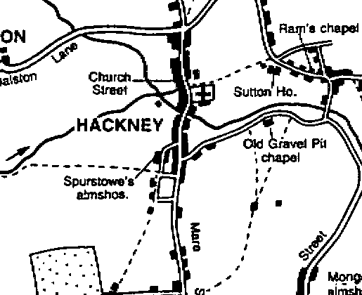
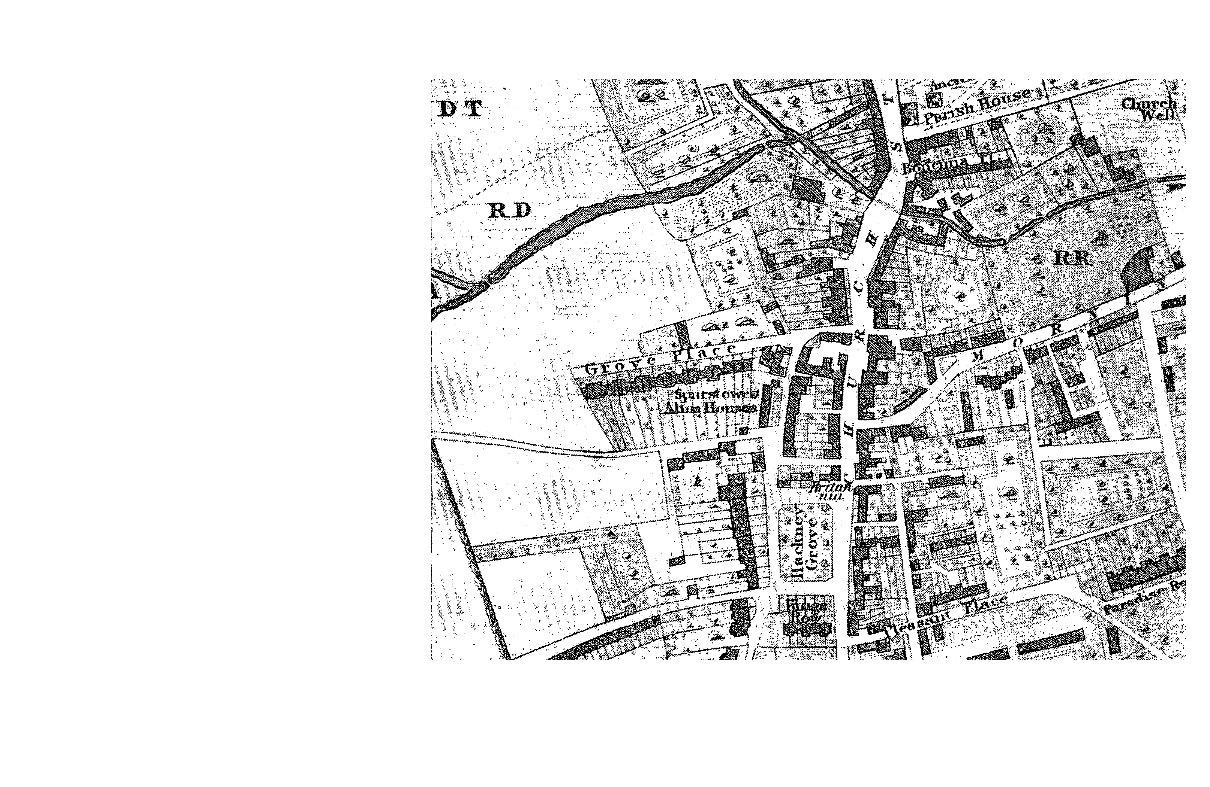
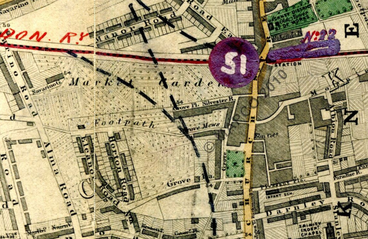
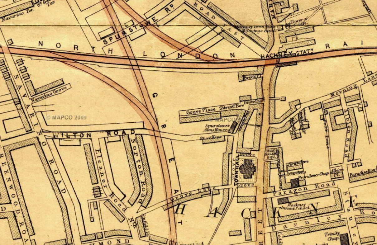
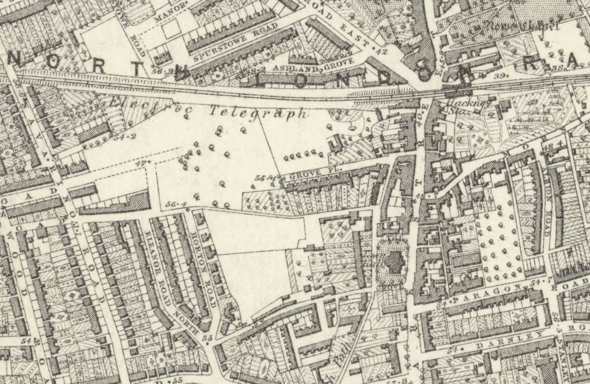
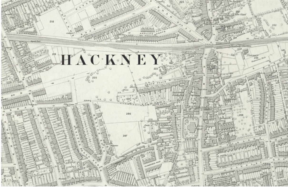
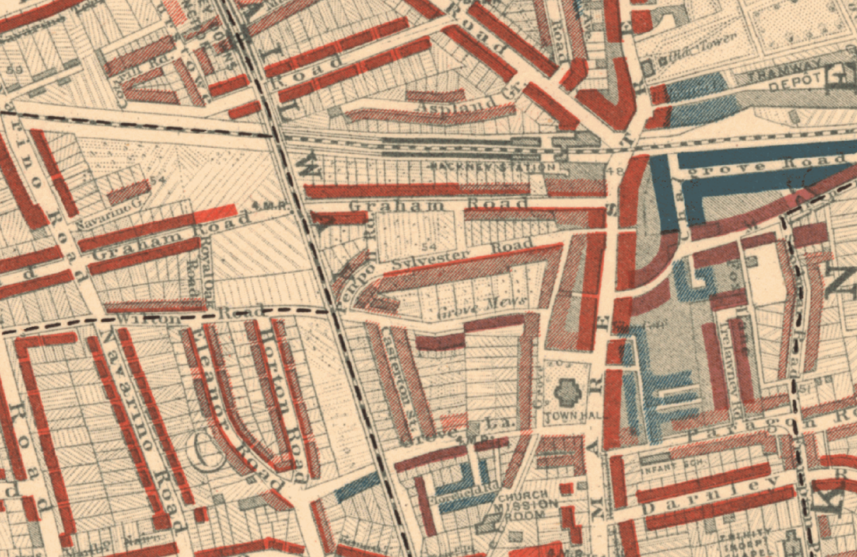
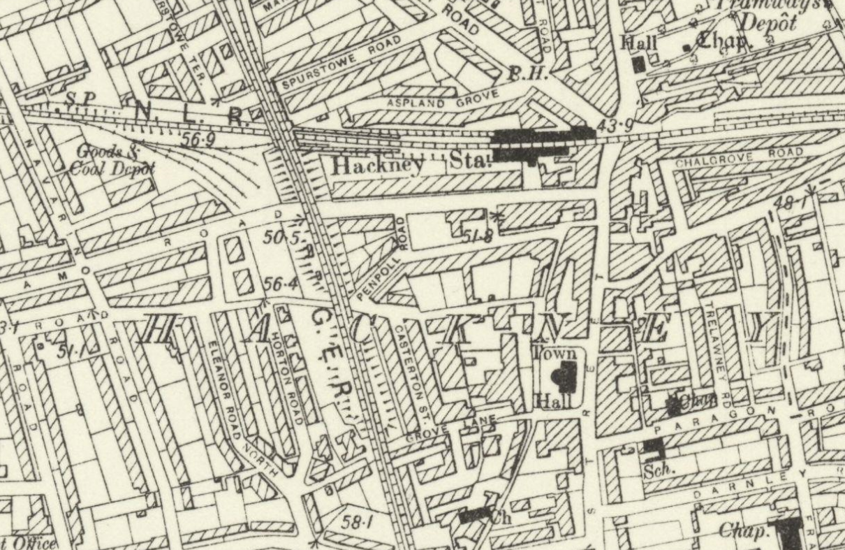
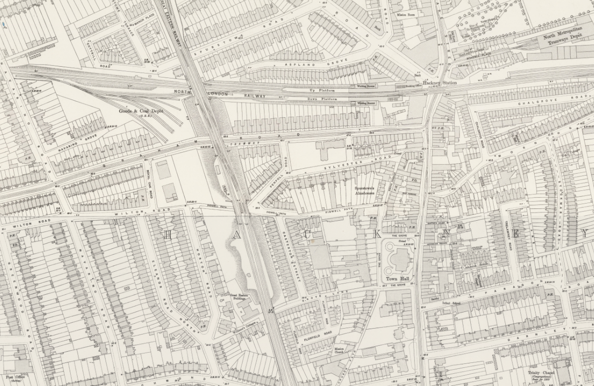
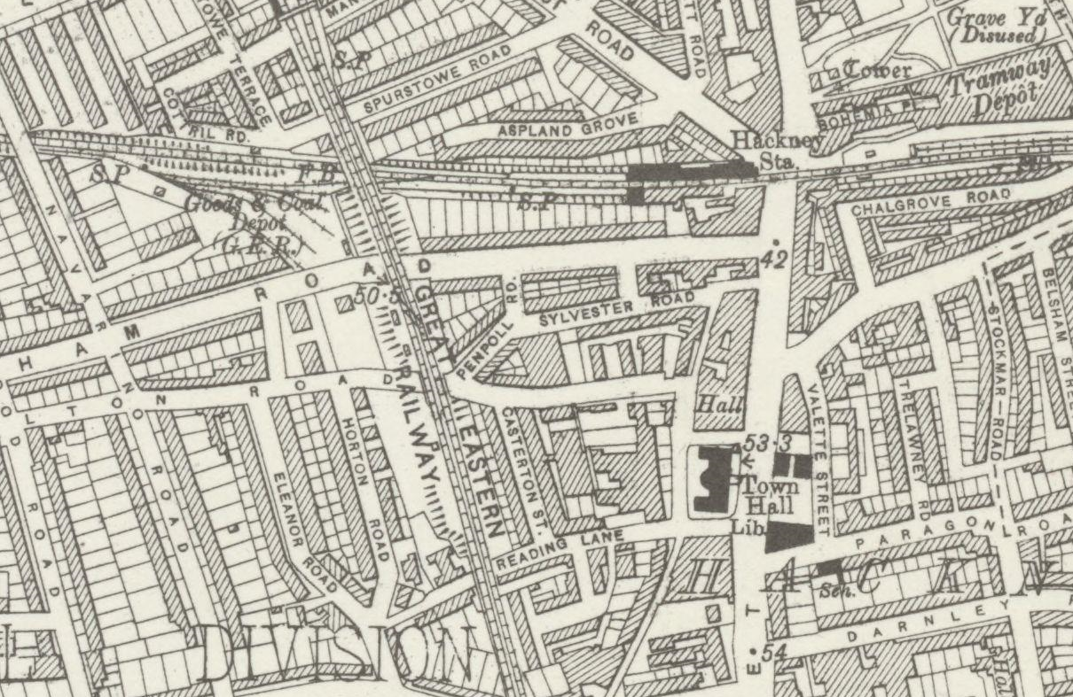
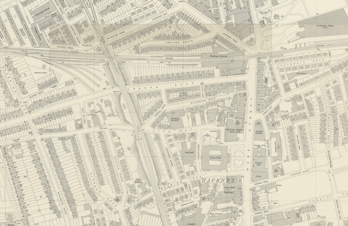
| Title | Glimpses of Ancient Hackney and Stoke Newington Being a reprint of a series of articles appearing in the Hackney Mercury, from April 23rd, 1892, to November 25th 1893 |
|---|---|
| Author | F. R. Clarke 1893 |
| Source | London School of Economics |
|---|---|
| Author | Charles Booth |
| Map | Maps Descriptive of London Poverty |
The red line on the south side of Sylvester Road indicates the residents in the houses there were in the "Middle class. Well-to-do." social class (see What were the poverty maps?).
| Source | National Library of Scotland |
|---|---|
| Publisher | Ordnance Survey |
| Series | Six-inch England and Wales, 1842 - 1952 |
| Region | London |
| Sheet | London Sheet VII.NE |
| Revised | 1893 to 1894 |
| Published | 1894 to 1896 |
| Source | National Library of Scotland |
|---|---|
| Publisher | Ordnance Survey |
| Series | Five feet to the Mile, 1893-1896 |
| Region | London |
| Sheets |
Sheet VII.8
Sheet VII.18 |
| Revised | 1893 |
| Published | 1895 |
From https://booth.lse.ac.uk/notebooks
| Source | London School of Economics |
|---|---|
| Reference | BOOTH/B/347 |
| Title | George H.Duckworth's Notebook: Police District 13 [South Hackney and Hackney], District 14 [West Hackney and South East Islington] and District 16 [Highbury, Stoke Newington, Stamford Hill] |
| Description | Walk with Inspector Thomas Fitzgerald, District 13 [South Hackney and Hackney], 30 August [1897] |
| Page | 31 / 249 |
| Source | National Library of Scotland |
|---|---|
| Publisher | Ordnance Survey |
| Series | Six-inch England and Wales, 1842 - 1952 |
| Region | London |
| Sheet | London Sheet K |
| Revised | 1913-1914 |
| Published | 1920 |
| Source | Hackney Archives |
|---|---|
| Reference | M1461 |
| Title | SURVEY, CORRESPONDENCE and PAPERS |
| Description | Of Ellis & Son concerning the Union rating of the factory of Stapley & Smith, Pigwell Path, Sylvester Road. Confidential |
| Date | November 1925 |
From COSGB
| Source | National Library of Scotland |
|---|---|
| Publisher | Ordnance Survey |
| Series | National Grid maps, 1940s-1960s - TQ Grid Square |
| Region | London, TQ 100km square |
| Sheet | TQ3484NE - A |
| Revised | 1949 |
| Published | 1950 |
| Source | British History Online |
|---|---|
| Article | Hackney: Hackney Village |